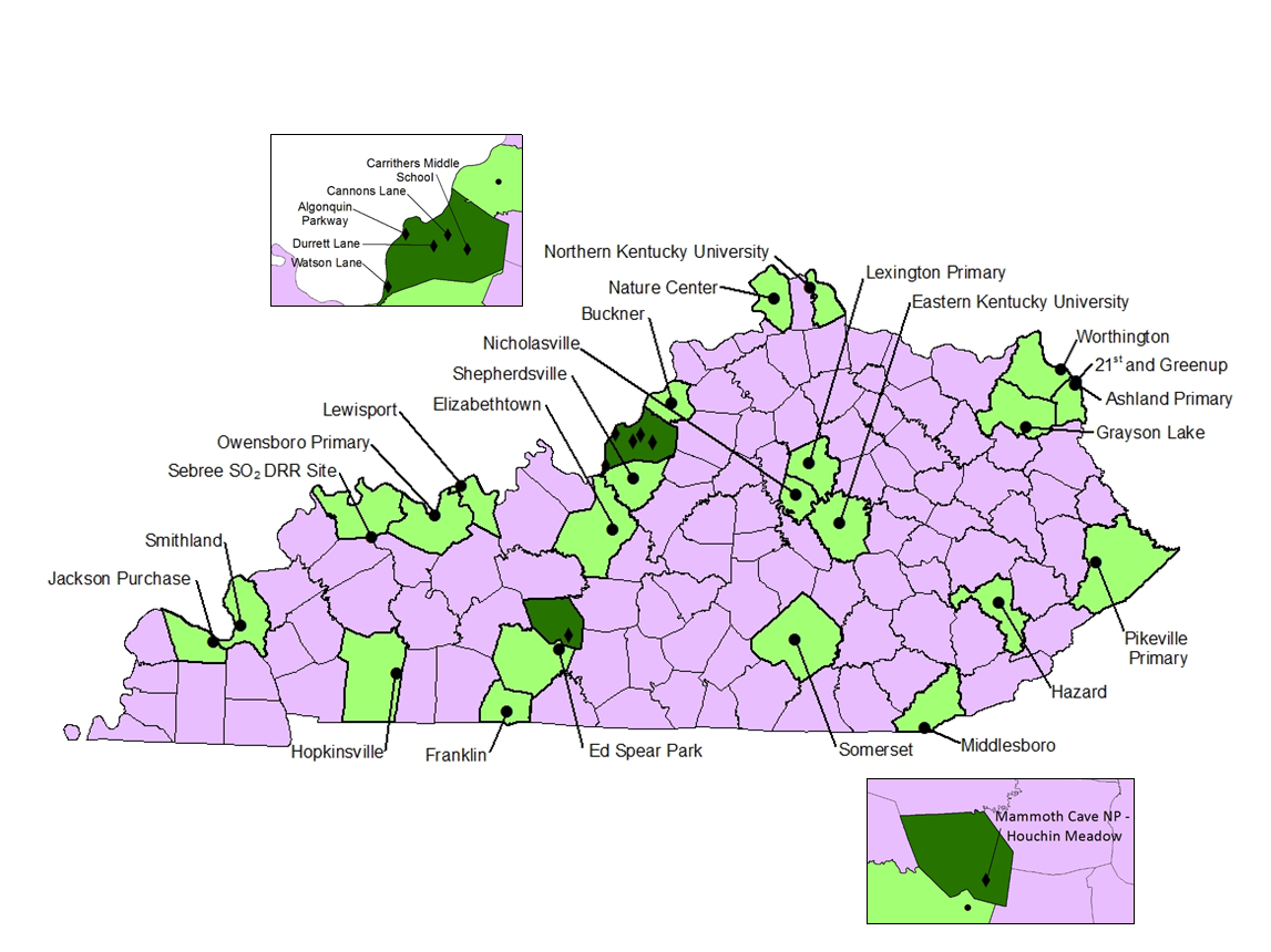
Kentucky's Air Monitoring Network

Kentucky's ambient air monitoring network.
Sites and Locations
The combined total ambient air monitoring network consists of 103 instruments, including 7 meteorological stations, located at 30 sites across 25 counties.
The locations of the monitoring stations are selected in accordance with U.S. EPA regulatory requirements and are generally established near populous areas or pollutant sources. Each year the station locations are reviewed to ensure that adequate coverage is being provided.
Pollutants Measured
The majority of the Division for Air Quality’s ambient air monitoring network is designed to measure the six criteria pollutants, which EPA has determined pose the greatest risk to public health:
The remainder of the Kentucky’s ambient air monitoring network consists of sites and equipment designed to support the criteria pollutant network or to measure air pollutants for which National Ambient Air Monitoring Standards (NAAQS) do not exist. These include meteorological stations and air toxics monitoring stations.